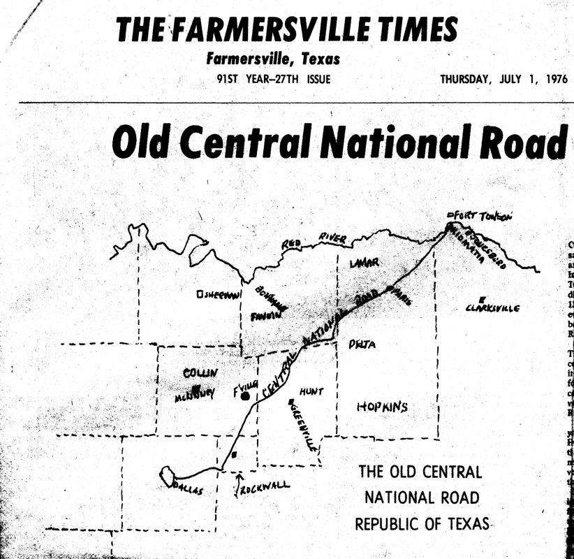
Central National Road of the Republic of Texas
|
Central National Road of
The Republic of Texas During its brief existence, the Congress of the Republic of Texas made significant efforts to plan for the inevitable increase in settlement. One of those efforts was the establishment of the Central National Road, designed to connect the Red River to existing military roads along the Trinity River and points farther west, thus opening much of Northeast Texas to both settlement and commerce. On February 5, 1844, the Congress created a five-man commission to supervise the surveying and construction of the road. Commission members, which included John Yeary, received land for their work. Yeary selected property in present Collin County and founded a settlement that grew to become Farmersville. The commissioners chose George Stell of Paris, Texas, as surveyor for the project. He began his work in April 1844 from a point now within the city of Dallas. He and his assistant traveled northeast, measuring and marking the exact route, which passed through present counties of Dallas, Rockwall, Collin, Hunt, Fannin, Lamar and Red River; only three of them had been formally organized at that time. The new route utilized existing prairies and natural stream crossings, and avoided obstacles like densely wooded areas. It ended at the Kiomatia Crossing of the Red River near present Jonesborough, Red River County. While records are unclear as to whether construction was ever completed, history shows the Central National Road was short-lived, soon replaced by the Preston Road and other early routes, and eventually by rail lines. It did, however, help open Northeast Texas to increased growth and development. Through Yeary’s association with the road and his settlement in Collin County, it also directly impacted the early growth in population of this area. Texas Historical Marker 2004 |

